“Chalisgaon: Where History Whispers and Culture Thrives in Maharashtra’s Heartland”
🔴 Introduction: Unraveling Chalisgaon’s Essence
Nestled in the Khandesh region of Maharashtra, Chalisgaon is more than just the second-largest city in Jalgaon District—it’s a tapestry of history, culture, and natural beauty. With its roots tracing back to ancient dynasties and its streets buzzing with modern life, this city offers a unique blend of old-world charm and contemporary vibrancy. Let’s embark on a journey through its storied past, architectural marvels, and the rhythms of daily life that make Chalisgaon unforgettable.
🟢 Detailed Introduction to Chalisgaon, Jalgaon District, Maharashtra
🔘 Geographic and Administrative Overview
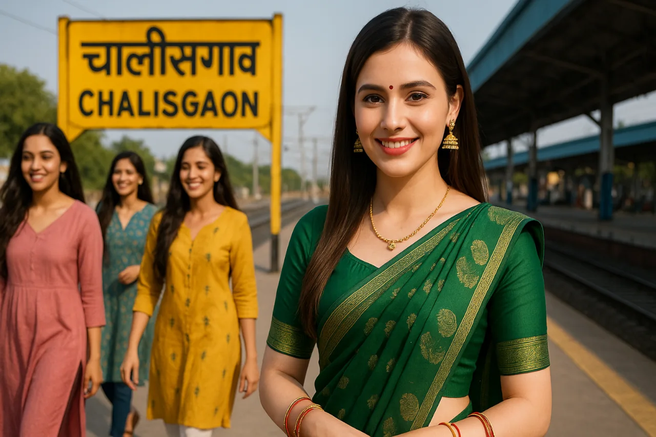
Chalisgaon, the second-largest city in Jalgaon District, Maharashtra, lies in the fertile Khandesh region at coordinates 20.47°N 75.02°E, with an average elevation of 344 meters. Strategically positioned 100 km from Jalgaon city and 330 km from Mumbai, it serves as a vital hub for trade and transportation, connected by National Highway 211 and State Highways 18 and 24. The city’s municipal council oversees 33 wards, supporting a population of 97,551 (2011 Census), with Marathi and Ahirani as dominant languages.
🔘 Historical Legacy
Chalisgaon’s roots trace back to ancient dynasties like the Vakatakas (5th century CE), evidenced by copper plates found near Waghli village. During the medieval era, it thrived under the Yadavas of Devagiri as a trade corridor linking the Deccan and North India. The British colonial era marked a turning point with the establishment of Chalisgaon Junction in 1861, a key railway node under the Bhusawal division that spurred economic growth.
🔘 Climate and Natural Features
The city experiences a semi-arid climate, with summer temperatures soaring to 40°C and winter lows around 10°C. The Titur and Dongri rivers, tributaries of the Girna River, nourish its agricultural plains, while the nearby Girna Dam (35 km away) provides irrigation and scenic vistas. Monsoons (June–September) transform the region into a lush landscape, ideal for exploring waterfalls and trekking routes.
🔘 Demographics and Culture
As of 2011, Hindus constitute 80.7% of the population, followed by Muslims (16.1%). The city’s cultural fabric is woven with festivals like Ganesh Chaturthi and Diwali, celebrated fervently at landmarks such as the SSD Dham and Vitthal Rukmani Temple. Traditional Ahirani folk music and handicrafts like Warli painting reflect the region’s tribal influences.

🔘 Economic Backbone
Agriculture drives Chalisgaon’s economy, with cotton, bananas, and soybeans as primary crops. The city is also emerging as a solar energy hub, hosting projects like the Avaada Solar Guest House. Its railway junction facilitates the transport of goods, while local markets like Sadar Bazar bustle with trade in spices, textiles, and handicrafts.
🔘 Architectural Heritage
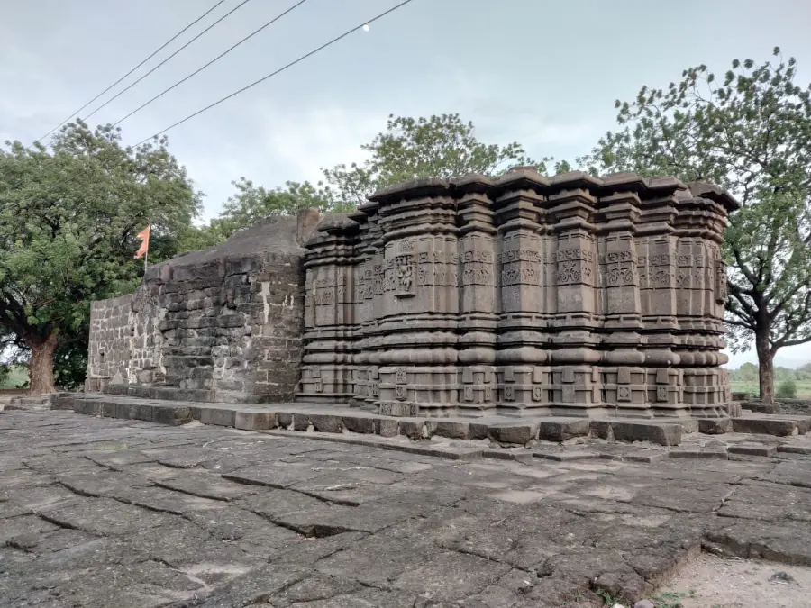
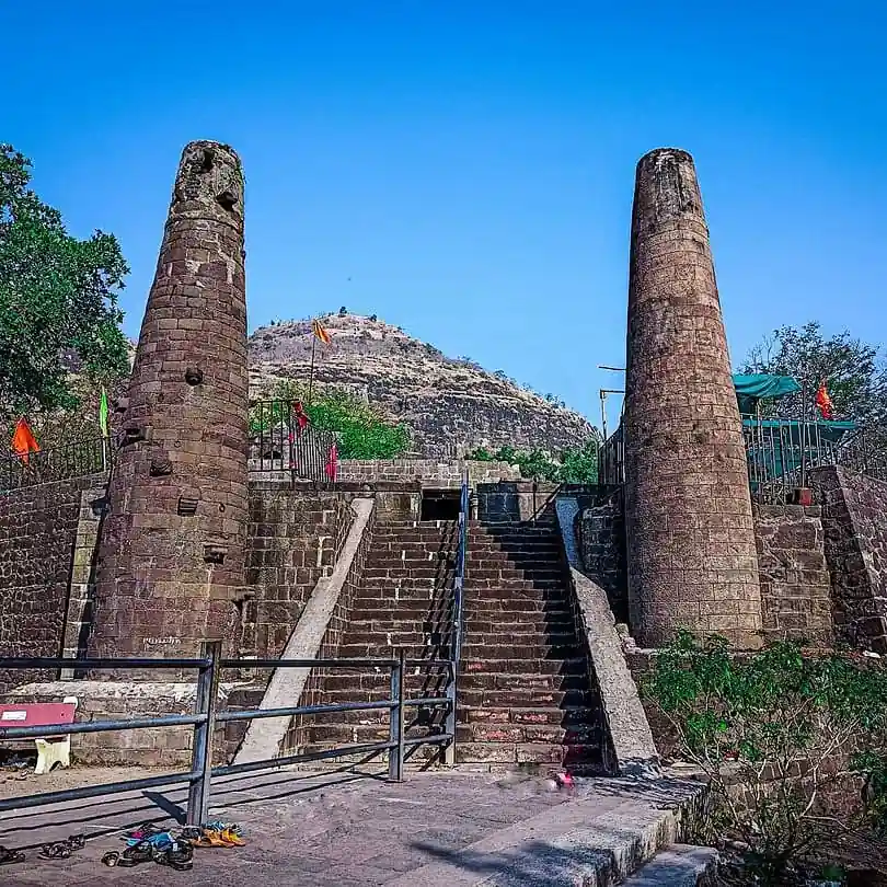
The 12th-century Padmalaya Kshetra, revered as one of India’s “Half Ganapati Peeths”, crowns a hilltop with intricate carvings and smaller surrounding temples. Colonial-era landmarks include the Chalisgaon Junction, featuring Gothic arches, and the Swinging Towers of Farkande (16 km away), a medieval marvel where towers vibrate in unison.
Also Read
Bibi Ka Maqbara Aurangabad – Entry Fee, Timings, History, Built by, Images, Location & more
🔘 Connectivity and Modern Infrastructure
Chalisgaon is well-linked by rail, road, and air. The Chalisgaon Junction connects to Mumbai, Delhi, and Kolkata, while Aurangabad’s Chikkalthana Airport (85 km) and Jalgaon Airport (100 km) provide domestic flights. The city boasts modern amenities, including government hospitals, colleges, and cinema halls like Hans Raj Theatre.
🔘 Local Lifestyle and Community
Daily life revolves around Agrarian Rhythms, with bustling morning markets offering fresh produce like Jowar (Sorghum) and Tur Dal. The city’s communal harmony is evident in landmarks like the Badi Masjid and Mahakali Mandir, which host interfaith gatherings during festivals.
🟣 Section Breakdown:
👉 Historical Timeline – From Vakataka rule to British influence.
👉 Architectural Gems – Temples, railways, and colonial remnants.
👉 Cultural Tapestry – Festivals, dialects, and local crafts.
👉 Travel Essentials – Weather, distances, and itineraries.
👉 Local Life – Markets, cuisine, and economy.
🟠 Detailed Section Breakdown:
Explore Chalisgaon: History, Culture, and Travel Guide
⭕ History & Architecture: A Journey Through Time
➤ Granular Historical Timeline:
✦ Ancient Era (5th Century CE): Chalisgaon’s earliest mentions link it to the Vakataka dynasty, with copper plates found near Waghli village.
✦ Medieval Period: Under the Yadavas of Devagiri, the region flourished as a trade hub connecting the Deccan and North India.
✦ British Colonial Era: The arrival of railways in 1861 transformed Chalisgaon into a strategic junction, with Bhusawal becoming a key station.
➤ Architectural Highlights:
✦ Padmalaya Temple: A 12th-century shrine dedicated to Lord Ganesha, renowned for its intricate carvings and spiritual significance.
✦ Chalisgaon Junction: A colonial-era railway station with Gothic arches, reflecting British engineering.
✦ Swinging Towers of Farkande: A marvel of medieval architecture where towers vibrate in unison without physical connections.
➤ Local Insight: “Our ancestors say the Padmalaya Temple’s stones were blessed by saints—it’s where faith meets artistry”, shares Rajesh, a temple guide.
⭕ Distance from Major Cities
| City | Distance (km) | Travel Time (hrs) | Best Route |
| Aurangabad | 95 km | 2 hrs (by road) | Via NH 52 |
| Indore | 320 km | 6 hrs | Via NH 52 |
| Pune | 368 km | 6.5 hrs | Via Hindu Hrudaysamrat Balasaheb Thackeray Maharashtra Samruddhi Mahamarg and NH60 |
| Mumbai | 380 km | 6.5 hrs | Via Hindu Hrudaysamrat Balasaheb Thackeray Maharashtra Samruddhi Mahamarg |
| Nagpur | 545 km | 6.5 hrs | Via Hindu Hrudaysamrat Balasaheb Thackeray Maharashtra Samruddhi Mahamarg |
⭕ Travel Tips & Climatic Conditions
➤ Best Time to Visit:
✦ Winter (December–February): Pleasant temperatures (10°C – 25°C), ideal for sightseeing.
✦ Monsoon (June–September): Lush landscapes but occasional flooding; pack rain gear.
➤ Climate Table:
| Month | Avg. Temp (°C) | Rainfall (mm) |
| May | 40°C | 15mm |
| July | 30°C | 250mm |
| January | 18°C | 5mm |
➤ Monsoon Itinerary:
✦ Day 1: Explore Girna River’s waterfalls.
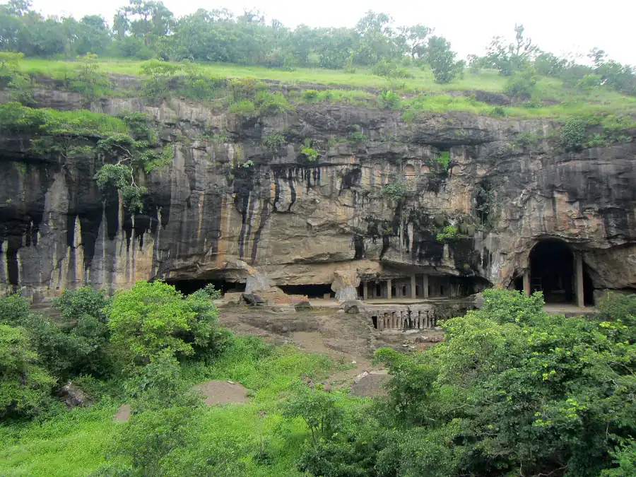
✦ Day 2: Visit Ajanta Caves (57 km away).
✦ Day 3: Attend the Changdeo Fair, a monsoon festival.
⭕ Best Places to Visit in Chalisgaon (Granular Details)
🎯 Padmalaya Kshetra
✦ History: A 12th-century temple dedicated to Lord Ganesha, believed to be one of India’s 2.5 sacred Ganpati Peeths.
✦ Architecture: Stone carvings depict scenes from Hindu epics; the temple’s Padukas (footprints) of Shri Govind Maharaj attract devotees.
✦ Best Time to Visit: Morning hours for serene Aarti (Prayer Rituals).
🎯 Chalisgaon Junction
✦ Colonial Heritage: Built in 1861, this railway station features Gothic arches and vintage signage.
✦ Nearby: The station’s SBI ATM and Deogiri Nagari Sahakari Bank cater to travellers.
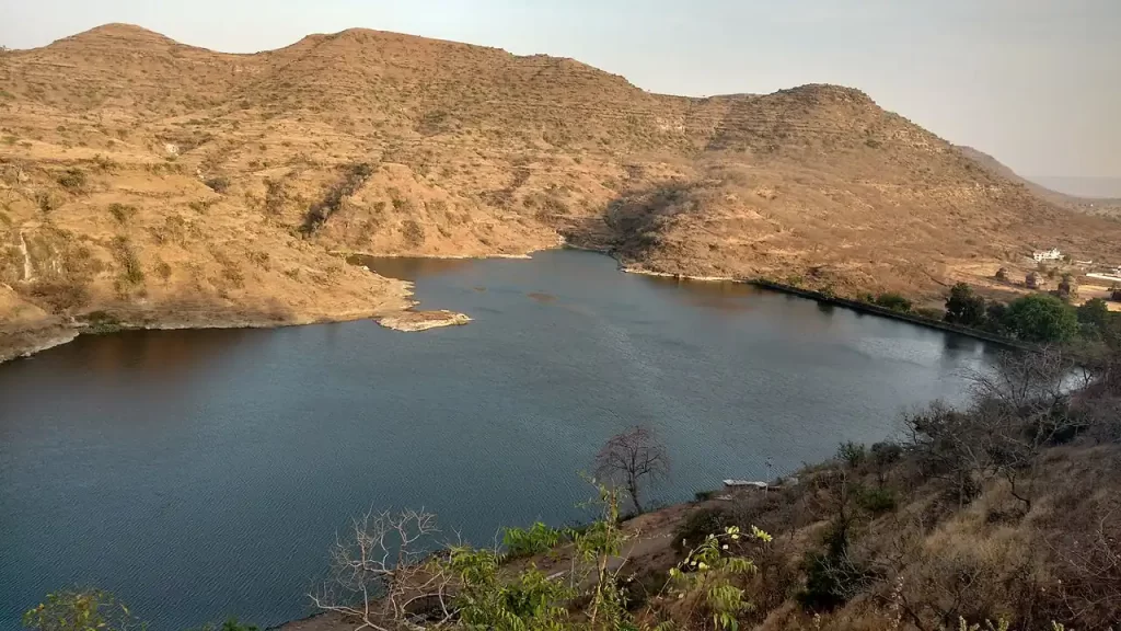
🎯 Girna Dam
✦ Distance: 35 km from Chalisgaon.
✦ Activities: Boating and picnicking amid monsoon-fed waterfalls. The dam’s reservoir supports irrigation across Jalgaon.
🎯 Swinging Towers of Farkande
✦ Engineering Marvel: Twin 15-meter towers constructed 250 years ago; pushing one causes the other to sway due to hidden resonance mechanics.
🎯 Manudevi Temple
✦ Location: Adgaon Village (Yawal Taluka).
✦ Unique Feature: A 7-river trek leads to this forested shrine, surrounded by Satpuda hills and monsoon waterfalls.
🎯 Local Markets
✦ Sadar Bazar: Shop for handwoven Paithani sarees and brassware.
✦ Herapur Road: Explore solar-powered street stalls selling organic farm produce.
🎯 Parola Fort
✦ Historical Significance: Built in 1727, linked to Rani Laxmibai’s family. The fort’s ramparts offer panoramic views of the Girna River.
⭕ Best Places for Refreshments with Authentic Local Food
👉 Sadar Bazar
✦ Specialties: Savour Bhakarwadi (Spicy rolled snacks) and Pithla-Bhakri (Gram Flour Curry with Millet Bread) at street stalls.
✦ Must-Try: Shev Bhaji (Fried Noodles in Tangy Curry) at Khandesh Bhojanalaya.
👉 Hotel Shri Ganesh
✦ Highlights: Known for Zunka Bhakar (Spiced Chickpea Porridge with Flatbread) and Varhadi Chicken, a fiery Khandeshi curry.
👉 Aryanivas Lodge
✦ Signature Dish: Puran Poli (Sweet lentil-stuffed flatbread) served with homemade Aamras (Mango pulp) during summer.
👉 Hans Theater Road Stalls
✦ Street Food: Relish Misal Pav (Sprouted Bean Curry with Bread) and Sabudana Khichdi (Tapioca Pearls with Peanuts).
👉 Local Sweet Shops
✦ Recommendation: Ganesh Mithaiwala offers Basundi (Thickened Milk Dessert) and Shrikhand (Sweet Yogurt) flavoured with saffron.
⭕ Demographics & Economy
✦ Population: 97,551 (2011 Census), with 80.7% Hindus and 16.1% Muslims.
✦ Languages: Marathi (official), Ahirani, Hindi.
✦ Economy: Cotton farming, banana plantations, and solar energy industries drive growth.
⭕ Notable People
✦ Pratibha Patil: India’s first female President, born in nearby Nadgaon.
🟤 FAQs
How to reach Chalisgaon by train?
Chalisgaon Junction connects to Mumbai, Delhi, and Kolkata. Daily trains include the Mumbai-Bhusawal Express.
What’s unique about Chalisgaon’s cuisine?
Try Bhakarwadi (Spicy snack) and Pithla-Bhakri (Gram Flour Curry with Millet Bread) at local markets.
🔵 Conclusion
Chalisgaon is a microcosm of Maharashtra’s diversity—its ancient temples, bustling markets, and warm hospitality promise an enriching experience. Whether you’re a history buff, nature lover, or foodie, this city will leave you spellbound.
This guide synthesises historical, cultural, and practical insights, ensuring a comprehensive exploration of Chalisgaon’s essence.
Ready to explore Chalisgaon? Start planning your adventure today—click here for custom itineraries!
🟡 Sources:
⦿ Wikipedia – Chalisgaon, Jalgaon District Gazetteer, AccuWeather, Maharashtra Tourism Board.
⦿ Featured Image Credit: Wikimedia Commons
⦿ Wikimedia Commons – Chalisgaon Railway station
⦿ Wikimedia Commons – 17-Chalisgaon
⦿ Commons – Pitalkhora overview
⦿ Wikimedia Commons – PATNADEVI MATA TEMPLE
⦿ Wikimedia Commons – Mudhai Devi temple – side view
⦿ Wikimedia Commons – Gautala lake
For more information, you can visit our website: ExploreXP
Loved this guide? Share it with fellow travellers and tag #DiscoverChalisgaon!
Latest Posts
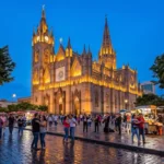
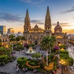
- 15 Unique Things to Do in Guadalajara Like a Local

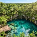
- 7 Best Places to Live in the Yucatan Peninsula in 2026
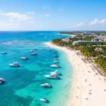
- Living in Playa del Carmen: The Complete Expat Guide to Costs, Safety & Lifestyle (2026)
- Living in Guadalajara: Costs, Safety & Daily Life
- Living in Chiang Mai: What Every Expat Should Know in 2026
- Living in Mérida: Costs, Neighborhoods, Pros and Cons Explained